
According to meteorologist Natalka Didenko, colder air masses are gaining strength, frosts are intensifying, and atmospheric fronts are preparing to blanket the country in snow.
On Monday, nighttime temperatures will fluctuate between 0 and -4 degrees Celsius, while daytime temperatures will range from -2 to +3 degrees. Most regions can expect brief light snowfall, while the southern and southeastern parts of the country are forecasted to experience heavier precipitation, including wet snow that may stick and create hazardous driving conditions.
Additionally, in some areas, particularly Crimea, significant precipitation is expected by midday.
The wind will predominantly blow from the northwest at a moderate intensity. However, in western regions, gusts may reach 15-20 meters per second, increasing the likelihood of challenging weather conditions.
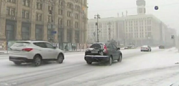
In Kyiv, temperatures will also drop: at night, it will fall to -1 to -3 degrees, while during the day it will hover around zero. Light snow is expected, along with the possibility of icy roads, complicating travel.
Later this week, the cold will intensify, with nighttime temperatures dropping to -3 to -8 degrees, and daytime temperatures remaining between -3 and -2 degrees. Given the potential for power outages due to worsening weather conditions, Didenko advises preparing in advance.
Although severe frosts are not currently forecasted, it is advisable to bundle up and stay warm as winter reasserts itself.
Let us remind you, February brings a "Glacial Period": freezing temperatures below -20 and snowfalls may lead to not only power outages
Earlier, "hyser" reported, anomalous weather in winter – a harbinger of great trouble: a hellish summer could turn Ukraine into a "Sahara," with crops and gardens disappearing?
As reported by “hyser,” a harsh February will send spring weather into retirement: a snowstorm and severe frosts are already at the doorstep